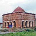
District Profile
The District Uttar Dinajpur came into existence on 1st April 1992 vide Gazette Notification No. 177 L.R / 6M-7/92 dated 28.2.1992. It is located in the north of West Bengal.It is butted and bounded by Bangladesh on the East [length of border 227 KM], Bihar on the West, Darjeeling and Jalpaiguri on the North and Malda on the South. The NH 34 and NH 31 passes through the District.
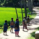
The district is constituted of nine Blocks under two Sub-Divisions namely Raiganj and Islampur. This is a multi-lingual district dominated by Bengali speaking and there are Urdu and Hindi speaking population in the Islampur area.The district of Uttar Dinajpur lies between 250 10′ to 260 35′ North latitude and 870 45′ to 880 35′ East longitude covering an area of 3,142 sq.km.
| Area | 3142 sq KM |
| District Head Quarter | Raiganj |
| Sub-Division | 2 |
| Block/ Panchayat Samity | 9 |
| Municipality | 4 |
| Gram Panchayat | 98 |
| Gram Sansad | 1632 |
| Mouza | 1504 |
| Police Station | 9 |
| Total Population (2011 Census) | 3007134 |
| Male Population (2011 Census) | 1551066 (51.58%) |
| Female Population (2011 Census) | 1456068 (48.42%) |
| Sex Ration (2011 Census) Female / 1000 Male) | 936 |
| Total No of Household (2011 Census) | 605674 |
| Population per SqKM (2011 Census) | 956 |
| Growth Rate | 22.90% |
| Total SC Population (2011 Census) | 847950 (28.26%) |
| Total ST Population (2011 Census) | 162816 (5.43%) |
| % of Literacy (2011 Census) | 60.13% |
| % of Male Literacy (2011 Census) | 55.03% |
| % of Female Literacy (2011 Census) | 43.69% |
| No of Electrified Mouza | 1492 |
| No of Primary Schools | 1839 |
| No of High Schools | 271 |
| No of Degree Colleges | 5 |
| No of Universities | 1 |
| No of Technical Schools | 4 |
| No of Teachers’ Training College | 3 |
| No of Sishu Siksha Kendra | 981 |
| No of Madhyamik Siksha Kendra | 107 |
| No of A.W.W Centre | 500** |
| No of District Hospital | 1 |
| No of Sub-Divisional Hospital | 1 |
| No of State General Hospital | 1 |
| No of BPHC | 9 |
| No of PHC | 18 |